


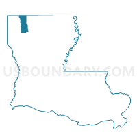
Precinct 7B, Webster Parish, Louisiana
About
Outline

Summary
| Unique Area Identifier | 591303 |
| Name | Precinct 7B |
| County | Webster Parish |
| State | Louisiana |
| Area (square miles) | 1.32 |
| Land Area (square miles) | 1.29 |
| Water Area (square miles) | 0.03 |
| % of Land Area | 97.40 |
| % of Water Area | 2.60 |
| Latitude of the Internal Point | 32.98049880 |
| Longtitude of the Internal Point | -93.42825980 |
Maps


Graphs
Select a template below for downloading or customizing gragh for Precinct 7B, Webster Parish, Louisiana


Neighbors
Neighoring Voting District (by Name) Neighboring Voting District on the Map
- Precinct 11, Webster Parish, LA
- Precinct 2, Webster Parish, LA
- Precinct 6, Webster Parish, LA
- Precinct 9, Webster Parish, LA
Top 10 Neighboring County Subdivision (by Population) Neighboring County Subdivision on the Map
- District 3, Webster Parish, LA (3,459)
- District 4, Webster Parish, LA (3,344)
- District 2, Webster Parish, LA (2,607)